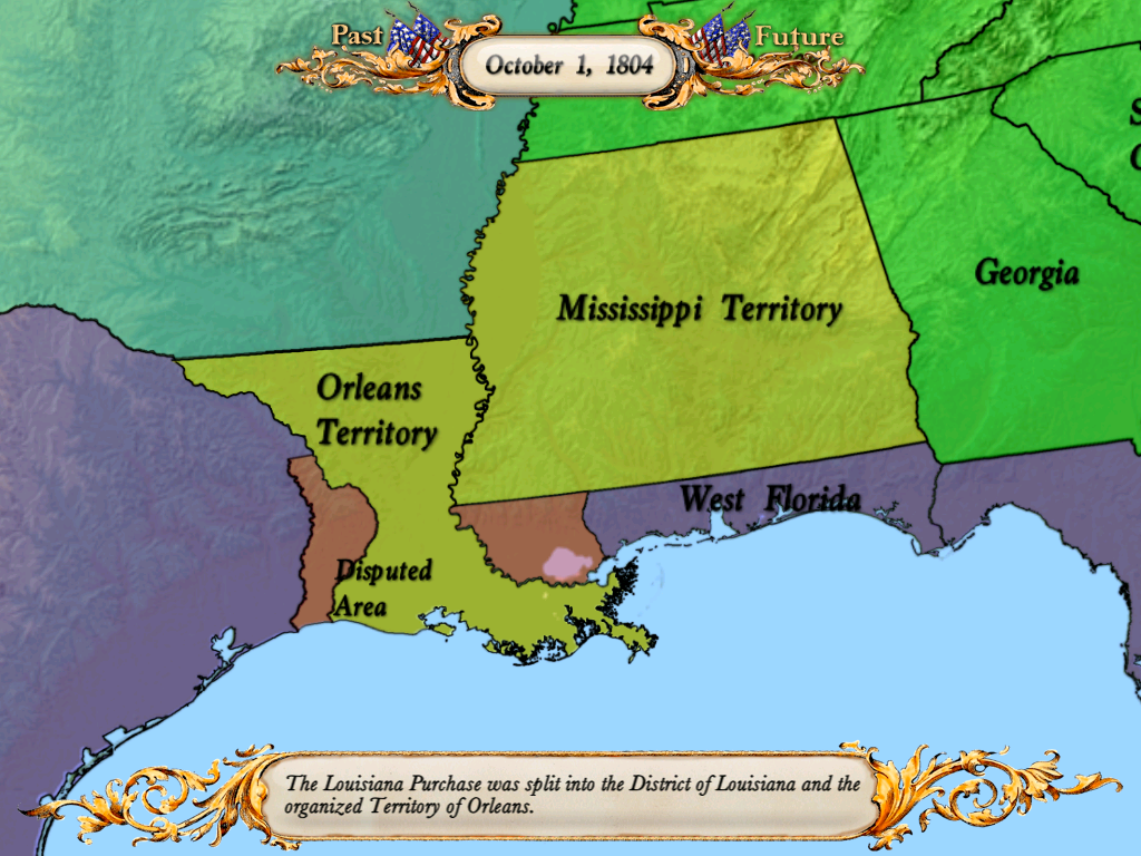
After a lot of analysis over the boundaries between the Spanish region of Texas and the Orleans Territory, I have finally found someone who agrees with my map.
http://www.thecajuns.com/1805map.html
From Wikipedia: http://en.wikipedia.org/wiki/Sabine_Parish,_Louisiana
Boundary disputes followed the purchase. The United States claimed the Sabine River as the border and Spain claimed a line farther east in Louisiana along Arroyo Hondo, a tributary of the Red River. The Neutral Ground Treaty was affected in 1806, declaring the area “Sabine Free State,” a demilitarized zone, which became the neutral strip for outlaws, desperadoes, criminals and filibusters. The strip extended, roughly, from Sabine River east to the Calcasieu River, Bayous Kisatchie and Don Manuel, Lac Terre Noir and the Arroyo Hondo. Both nations claimed ownership but neither exercised control. English speaking settlers from the older eastern states began moving into the section during the westward expansion years before the boundary was established. They settled on Spanish grants known as Rio Hondo claims. One of the earliest settlers was Thomas Arthur, who filed a claim for 640 acres (2.6 km2) on Negreet Creek.
http://www.knowla.org/entry/754/&view=summary&ref=region&refID=3

